
From 2018 to 2020, 2,795 fatal crashes occurred in New Mexico. MoneyGeek studied 459 roads out of the state's 150,216 miles to identify the most dangerous stretches. The analysis also examined driver behaviors, including distracted driving, speeding and drunk driving, along with factors like weather and time of year.
New Mexico Fatal Accident Study:
New Mexico’s Deadliest Roads and Fatal Accident Statistics
Updated: July 31, 2026
Advertising & Editorial Disclosure

Key Findings
- Central Ave. from San Mateo Blvd. SE to Dorado Pl. SE in Albuquerque is the deadliest stretch of road in New Mexico, with 15 fatal crashes from 2018 to 2020.
- Speeding contributed to 35% of fatal accidents; drunk driving was involved in 28%.
- Distracted driving was involved in 36% of fatal crashes. MoneyGeek’s distracted driving study ranks New Mexico as the worst state for distracted driving.
- October recorded the most fatal accidents of any month, at 10.6%. December (9.2%) and July (8.9%) followed.
- Bernalillo had more fatal accidents than any other county, most of them along I-4.
10 Deadliest Road Stretches in New Mexico
- 1. Central Ave. from San Mateo Blvd. SE to Dorado PI. SECities:Albuquerque
 Albuquerque
- 15Fatal Accidents
- 15fatalities
- 3Crashes Per Mile
- 4.7 milesdistance
- (35.07760556, -106.58608329999998)start
- (35.06871944, -106.50365559999999)end
- [ 0 1 2 4 5 7 9 11 12 14 15 16 17 18 21]points
- 48ordering
- {'Albuquerque'}localities
- {'Bernalillo'}counties
- TRUEintersect
- Central AveTWAY_ID
- 2. I-40 from Exit 154 to Exit 158Cities:Albuquerque
 Albuquerque
- 9Fatal Accidents
- 10fatalities
- 2Crashes Per Mile
- 4.1 milesdistance
- (35.09838611, -106.720925)start
- (35.10653611, -106.6486389)end
- [11 18 21 27 33 49 53 62 75]points
- 20ordering
- {'Albuquerque'}localities
- {'Bernalillo'}counties
- TRUEintersect
- I-40TWAY_ID
- 3. SR-45 Redlands Rd. NW to Central Ave. SWCities:Albuquerque
 Albuquerque
- 9Fatal Accidents
- 9fatalities
- 3Crashes Per Mile
- 2.7 milesdistance
- (35.11924722, -106.70173059999999)start
- (35.08075833, -106.7106)end
- [ 0 2 4 5 9 12 14 15 16]points
- 30ordering
- {'Albuquerque'}localities
- {'Bernalillo'}counties
- TRUEintersect
- SR-45TWAY_ID
- 4. SR-118 from Navajo Blvd. to Rehoboth Dr.Cities:Gallup | Church Rock
 Gallup | Church Rock
- 7Fatal Accidents
- 8fatalities
- 2Crashes Per Mile
- 4.0 milesdistance
- (35.52555556, -108.58565279999999)start
- (35.53248889, -108.65675559999998)end
- [0 1 2 3 4 5 7]points
- 12ordering
- {'Gallup', 'Church Rock', 'Not Applicable'}localities
- {'Mckinley'}counties
- TRUEintersect
- SR-118TWAY_ID
- 5. I-40 from Exit 140 to Lost Horizon Dr. NWCities:Albuquerque | Other
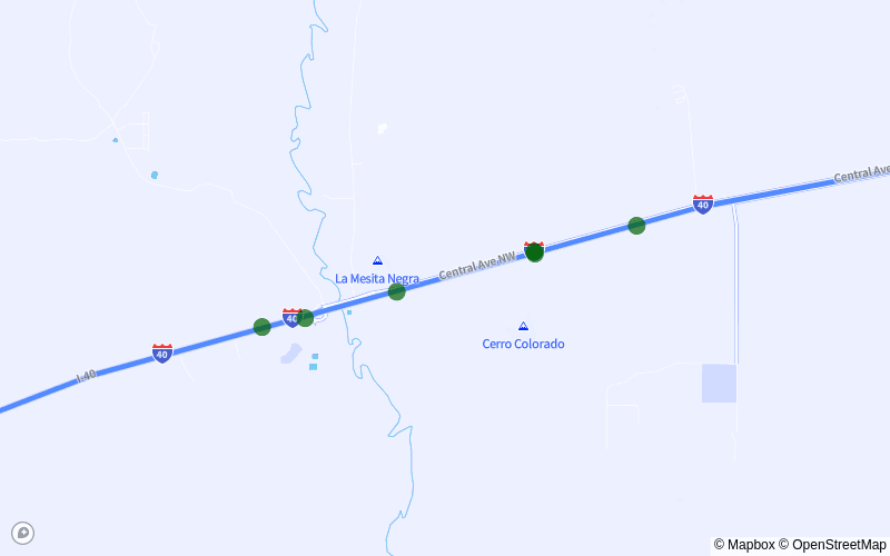 Albuquerque | Other
- 6Fatal Accidents
- 7fatalities
- 1Crashes Per Mile
- 4.8 milesdistance
- (35.02935278, -106.95905)start
- (35.04745556, -106.87729170000001)end
- [25 26 39 51 64 82]points
- 7ordering
- {'Albuquerque', 'Other'}localities
- {'Bernalillo'}counties
- TRUEintersect
- I-40TWAY_ID
- 6. I-25 from Exit 232 to Exit 226ACities:Albuquerque
 Albuquerque
- 6Fatal Accidents
- 6fatalities
- 1Crashes Per Mile
- 4.8 milesdistance
- (35.16898333, -106.58513329999998)start
- (35.10934444, -106.62753329999998)end
- [ 0 8 22 33 35 46]points
- 8ordering
- {'Albuquerque'}localities
- {'Bernalillo'}counties
- TRUEintersect
- I-25TWAY_ID
- 7. Gibson Blvd. SE from Valencia Dr. SE to Broadstone WayCities:Albuquerque
 Albuquerque
- 6Fatal Accidents
- 6fatalities
- 2Crashes Per Mile
- 2.6 milesdistance
- (35.05822222, -106.5808278)start
- (35.05851667, -106.62720279999999)end
- [0 1 2 3 4 5]points
- 14ordering
- {'Albuquerque'}localities
- {'Bernalillo'}counties
- TRUEintersect
- Gibson Blvd SeTWAY_ID
- 8. US-62 from Red Cloud Rd. to E-38Cities:Lea County
 Lea County
- 5Fatal Accidents
- 6fatalities
- 1Crashes Per Mile
- 4.5 milesdistance
- (32.52988333, -103.7967222)start
- (32.55464722, -103.7259722)end
- [ 0 2 5 8 13]points
- 6ordering
- {'Not Applicable'}localities
- {'Lea'}counties
- TRUEintersect
- US-62TWAY_ID
- 9. Central Ave from 1st St. SW to Volcano Rd. NWCities:Albuquerque
 Albuquerque
- 5Fatal Accidents
- 5fatalities
- 1Crashes Per Mile
- 4.5 milesdistance
- (35.08415278, -106.64810559999998)start
- (35.07608889, -106.72775559999998)end
- [ 3 6 8 10 19]points
- 5ordering
- {'Albuquerque'}localities
- {'Bernalillo'}counties
- TRUEintersect
- Central AveTWAY_ID
- 10. SR-45 from Kirsten Rd SW to Huseman PI. SWCities:Albuquerque
 Albuquerque
- 5Fatal Accidents
- 5fatalities
- 2Crashes Per Mile
- 2.9 milesdistance
- (35.00401667, -106.7172111)start
- (35.04514722, -106.7097139)end
- [ 1 3 7 11 13]points
- 9ordering
- {'Albuquerque'}localities
- {'Bernalillo'}counties
- TRUEintersect
- SR-45TWAY_ID
Drunk Driving Involved in 28% of Fatal Accidents
Of the 2,795 fatal crashes recorded in New Mexico between 2018 and 2020, 296 involved drunk driving.
State law considers drivers with a blood alcohol concentration (BAC) of 0.08% legally impaired. Alcohol begins affecting a driver's ability to operate a vehicle at a lower BAC. A BAC of 0.02% is enough to cause slow reaction time, lack of coordination and reduced concentration.
A drunk driving conviction can result in license suspension, restricted driving privileges or jail time, even when no fatality occurs. Convictions also lead to higher auto insurance rates in New Mexico.
Speeding Is a Factor in 35% of Fatal Crashes
From 2018 to 2020, speeding contributed to 370 fatal crashes in New Mexico, or 35% of all fatal accidents in the state.
Exceeding the legal speed limit increases the likelihood of losing control and extends stopping distances. It also raises the risk of severe injury, as higher speeds reduce the effectiveness of safety equipment inside and outside the vehicle.
Distracted Driving Contributed to 36% of Fatal Accidents
Distracted driving was involved in 382 deadly crashes in the state, or 36% of all fatal accidents. MoneyGeek's distracted driving study found New Mexico to be the worst state in the country for distracted driving, with the highest distracted driving fatality rate.
October Had More Fatal Accidents Than Any Other Month
October recorded the most fatal crashes of any month between 2018 and 2020, with 112 deaths, or 10.6% of all fatalities. December (98) and July (94) ranked second and third.
Safe Driving Has Financial Consequences, Too
Safe driving reduces road fatalities and lowers insurance costs for individual drivers. Even cautious drivers can be involved in accidents. Car insurance is an important financial safeguard.
Full coverage insurance in New Mexico averages $1,133 a year. Rates in Albuquerque, the state's most populous city, average the same. Drivers in other parts of the state pay different rates based on age, driving history and other factors. Rates also vary between insurers; comparing quotes from multiple providers helps identify the most affordable coverage options.
Fatal Accidents and Most Dangerous Roads: County Breakdown
The five counties in New Mexico with the most fatal accidents accounted for nearly 60% of all fatal crashes, or 634 over three years.
Bernalillo recorded 287 fatal crashes, the most of any county. Most occurred along I-4 and involved distracted driving and speeding.
Methodology
MoneyGeek analyzed fatality data from 2018 to 2020 using the National Highway Traffic Safety Administration Fatality Analysis Reporting System (FARS) database, the most recent data at the time of this study.
About Doug Milnes, CFA

Doug Milnes is a CFA charterholder with over 10 years of experience in corporate finance. He led the Credit Cards vertical at MoneyGeek. At Duff and Phelps, he performed valuations. He later conducted financial planning and analysis at several other companies. His analysis has been cited by U.S. News & World Report, The Hill, the Los Angeles Times, the New York Times and many other outlets.
Doug holds a master's degree in data science from Northwestern University. He writes about credit card strategy, including debt management and rewards.
Sources
- Federal Highway Administration. "Highway Statistics Series." Accessed July 31, 2026.
- National Highway Traffic Safety Administration. "Speeding." Accessed July 31, 2026.
- National Highway Traffic Safety Administration. "Fatality Analysis Reporting System (FARS)." Accessed July 31, 2026.