Georgia Fatal Accident Study:

Georgia’s Deadliest Roads and Fatal Accident Statistics

Updated: July 31, 2026

Advertising & Editorial Disclosure

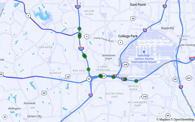
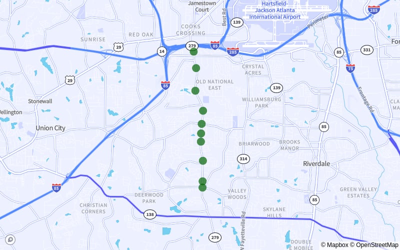
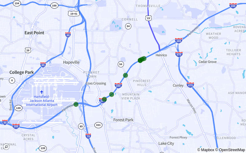
Georgia Map Of Fatal Accidents

MoneyGeek looked into the 4,307 recorded fatal crashes in Georgia from 2018 to 2020 to identify which roads are the deadliest in the state. Out of Georgia's 272,662 miles of road, the analysis examined 2,404 roads.

The study also explored factors behind the crashes. Some factors, like drunk driving, distracted driving and speeding, are tied to driver behavior. Others, like weather and time of year, relate to the environment. You can also find county-level data on Georgia's deadliest roads.

Key Findings

  • Moreland Ave. (Georgia 42) from S. River Industrial Blvd. SE to Wylie St. SE is the deadliest stretch of road in Georgia. Between 2018 and 2020, 12 fatal accidents occurred here.
  • Drunk driving and speeding were the most significant contributors to fatal accidents in Georgia. Twenty percent of all deadly crashes involved drunk driving, while speeding accounted for 18.7%.
  • Georgia has one of the lowest rates of distracted driving of any state. Distracted driving was involved in just 3.6% of the state's fatal crashes from 2018 to 2020. Georgia ranks better than 88% of states for distracted driving fatalities, according to MoneyGeek’s distracted driving study.
  • October had the highest number of deadly crashes of any month from 2018 to 2020, with 396 fatal accidents; that’s 9.2% of all recorded deadly crashes in Georgia. September and November had the next-highest numbers, at 394 and 384.
  • Fulton had the most fatal accidents of any county. The majority of these accidents occurred on I-285.

10 Deadliest Road Stretches in Georgia


  • 1. Moreland Ave. (Georgia 42) from S. River Industrial Blvd. SE to Wylie St. SE
    Cities:Decatur | Atlanta
    Moreland Ave. (Georgia 42) from S. River Industrial Blvd. SE to Wylie St. SEDecatur | Atlanta

    • 12Fatal Accidents
    • 13fatalities
    • 3Crashes Per Mile
    • 5distance
    • (33.68293889, -84.34748056)start
    • (33.75204167, -84.35166111)end
    • [ 0 1 4 5 6 7 8 9 12 14 16 17]points
    • 30ordering
    • {'Not Applicable', 'Decatur', 'Atlanta'}localities
    • {'Dekalb', 'Fulton'}counties
    • TRUEintersect
    • Georgia 42TWAY_ID

  • 2. I-20 from Exit 71 to Exit 65
    Cities:Decatur
    I-20 from Exit 71 to Exit 65Decatur

    • 11Fatal Accidents
    • 11fatalities
    • 2Crashes Per Mile
    • 5distance
    • (33.70272222, -84.18688611)start
    • (33.71336667, -84.27238333)end
    • [ 2 13 18 23 26 30 42 53 55 57 60]points
    • 24ordering
    • {'Not Applicable', 'Decatur'}localities
    • {'Dekalb'}counties
    • TRUEintersect
    • I-20TWAY_ID

  • 3. The Perimeter (I-285) from the Rt. 6 Interchange to the Riverdale Rd. Exit
    Cities:East Point | Other | College Park
    The Perimeter (I-285) from the Rt. 6 Interchange to the Riverdale Rd. ExitEast Point | Other | College Park

    • 11Fatal Accidents
    • 11fatalities
    • 3Crashes Per Mile
    • 4distance
    • (33.65966111, -84.49774444)start
    • (33.61626111, -84.44113056)end
    • [ 4 7 9 11 14 22 38 43 44 45 53]points
    • 27ordering
    • {'Not Applicable', 'East Point', 'Other', 'College Park'}localities
    • {'Clayton', 'Fulton'}counties
    • TRUEintersect
    • I-285TWAY_ID

  • 4. The Perimeter (I-285) from the Bouldercrest Rd Exit to the I-20 interchange
    Cities:Decatur
    The Perimeter (I-285) from the Bouldercrest Rd Exit to the I-20 interchangeDecatur

    • 10Fatal Accidents
    • 10fatalities
    • 2Crashes Per Mile
    • 5distance
    • (33.68452778, -84.309075)start
    • (33.71483333, -84.24074722)end
    • [ 6 12 13 15 18 32 34 36 47 57]points
    • 22ordering
    • {'Not Reported', 'Not Applicable', 'Decatur'}localities
    • {'Dekalb'}counties
    • TRUEintersect
    • I-285TWAY_ID

  • 5. Georgia 85 from Exit 237A to Springdale Dr.
    Cities:Forest Park | Riverdale
    Georgia 85 from Exit 237A to Springdale Dr.Forest Park | Riverdale

    • 10Fatal Accidents
    • 10fatalities
    • 3Crashes Per Mile
    • 4distance
    • (33.62662778, -84.40106944)start
    • (33.56906944, -84.41285556)end
    • [ 2 5 6 9 11 12 13 14 15 16]points
    • 25ordering
    • {'Forest Park', 'Not Applicable', 'Riverdale'}localities
    • {'Clayton'}counties
    • TRUEintersect
    • Georgia 85TWAY_ID

  • 6. Old National Hwy. (Georgia 279) between Bethsaida Rd. and the I-85 overpass
    Cities:Atlanta
    Old National Hwy. (Georgia 279) between Bethsaida Rd. and the I-85 overpassAtlanta

    • 10Fatal Accidents
    • 10fatalities
    • 3Crashes Per Mile
    • 4distance
    • (33.56301667, -84.46858056)start
    • (33.61799444, -84.47286389)end
    • [0 1 2 3 4 5 6 7 8 9]points
    • 26ordering
    • {'Not Reported', 'Not Applicable', 'Other'}localities
    • {'Fulton'}counties
    • TRUEintersect
    • Georgia 279 Old National HwyTWAY_ID

  • 7. I-85 from Exit 71 to Exit 77
    Cities:East Point | College Park | Atlanta
    I-85 from Exit 71 to Exit 77East Point | College Park | Atlanta

    • 9Fatal Accidents
    • 9fatalities
    • 2Crashes Per Mile
    • 4distance
    • (33.63751389, -84.45688056)start
    • (33.68426944, -84.40791111)end
    • [10 13 14 16 18 23 26 60 64]points
    • 19ordering
    • {'East Point', 'Not Applicable', 'College Park', 'Atlanta'}localities
    • {'Clayton', 'Fulton'}counties
    • TRUEintersect
    • I-85TWAY_ID

  • 8. I-285 from Exit 53 to South Loop Rd.
    Cities:Forest Park | Atlanta
    I-285 from Exit 53 to South Loop Rd. Forest Park | Atlanta

    • 8Fatal Accidents
    • 10fatalities
    • 2Crashes Per Mile
    • 4distance
    • (33.6626, -84.35271667)start
    • (33.63237778, -84.40643889)end
    • [ 3 10 19 31 39 41 54 56]points
    • 17ordering
    • {'Forest Park', 'Atlanta', 'Not Applicable'}localities
    • {'Clayton', 'Fulton'}counties
    • TRUEintersect
    • I-285TWAY_ID

  • 9. Georgia 6 from Riverside Pkwy. to Maxham Rd.
    Cities:Douglas County
    Georgia 6 from Riverside Pkwy. to Maxham Rd.Douglas County

    • 8Fatal Accidents
    • 9fatalities
    • 2Crashes Per Mile
    • 4distance
    • (33.73985, -84.58575556)start
    • (33.78858333, -84.62152778)end
    • [1 2 3 4 5 6 8 9]points
    • 16ordering
    • {'Not Applicable'}localities
    • {'Douglas'}counties
    • TRUEintersect
    • Georgia 6TWAY_ID

  • 10. I-285 from Exit 25 to US Hwy. 41
    Cities:Marietta | Sandy Springs
    I-285 from Exit 25 to US Hwy. 41Marietta | Sandy Springs

    • 7Fatal Accidents
    • 8fatalities
    • 2Crashes Per Mile
    • 5distance
    • (33.91260556, -84.38871667)start
    • (33.88648889, -84.46633333)end
    • [ 2 8 20 29 35 40 48]points
    • 10ordering
    • {'Not Applicable', 'Marietta', 'Sandy Springs'}localities
    • {'Fulton', 'Cobb'}counties
    • TRUEintersect
    • I-285TWAY_ID

Drunk Driving Involved in 20% of Fatal Accidents in Georgia

Between 2018 and 2020, drunk driving caused more fatal crashes in Georgia than speeding, distracted driving and winter weather. Those 860 collisions account for 20% of all fatal accidents statewide.

Georgia sets the legal BAC limit at 0.08%, but impairment starts well before that. Just two drinks push your BAC to 0.02%. At that level, your mood shifts and inhibitions drop. Multitasking and tracking moving objects get harder, and both matter for safe driving.

Death is the worst outcome of drunk driving, but the legal and financial consequences are serious. A DUI conviction means lost driving privileges, fines and jail time. Finding affordable car insurance in Georgia gets harder, too, since DUI drivers must carry Georgia SR-22 insurance, which costs more than standard coverage.

Speeding Is a Factor in 19% of Fatal Crashes

Speeding was involved in 18.7% of all fatal accidents recorded in Georgia from 2018 to 2020. That's 805 deaths.

Georgia isn't alone. The National Safety Council pegged speeding as a contributing factor to 29% of all fatal crashes in the U.S. in 2020. Speeding cuts reaction time in hazardous situations, lengthens stopping distance and makes safety equipment less effective.

Distracted Driving Contributed to 4% of Fatal Accidents

Distracted driving was a factor in 157 fatalities in Georgia. That’s 3.6% of deadly crashes between 2018 and 2020. MoneyGeek’s study on the worst states for distracted driving found Georgia ranked better than 88% of states.

In July 2018, Georgia’s Hands-Free Act took effect to address distracted driving. The law may account for the state's low distracted driving death toll.

October Had More Fatal Accidents Than Any Other Month

Beyond driver behaviors, MoneyGeek's study also looked at when fatal accidents were most likely to occur. October had the most deadly crashes: 396, or 9.2% of the total. September (394) and November (384) had the next-highest numbers.

Driving Safely Protects You, Others and Your Wallet

Driving responsibly helps keep Georgia’s roadways safe. Safe driving also protects your wallet. Collision repairs are expensive, but full coverage helps offset the cost.

The average cost of car insurance in Georgia is $1,638 per year. Rates vary based on where you live. For example, Atlanta, Georgia’s most populous city, auto insurance costs as much as the state average. Drivers in Augusta pay $1,200, a difference of $438.

The figures above are averages. Your personalized quote may show a different rate based on your age and driving history. Compare estimates from multiple providers to find the cheapest car insurance company.

Fatal Accidents and Most Dangerous Roads: County Breakdown

The five counties with the most deadly crashes accounted for 1,150 incidents. That’s over a quarter of all fatal accidents in Georgia between 2018 and 2020.

Among Georgia's counties, Fulton had the most fatal accidents at 375. Most of these occurred along I-285 and involved speeding and drunk driving.

Methodology

MoneyGeek analyzed 2018, 2019 and 2020 fatality data from the National Highway Traffic Safety Administration Fatality Analysis Reporting System (FARS) database.

About Doug Milnes, CFA


Doug Milnes

Doug Milnes is a CFA charterholder with over 10 years of experience in corporate finance. He led the Credit Cards vertical at MoneyGeek. At Duff and Phelps, he performed valuations. He later conducted financial planning and analysis at several other companies. His analysis has been cited by U.S. News & World Report, The Hill, the Los Angeles Times, the New York Times and many other outlets.

Doug holds a master's degree in data science from Northwestern University. He writes about credit card strategy, including debt management and rewards.


Sources